Winter Solstice — Stock Vector

Winter Solstice — Vector

Illustration of winter solstice on december 21. Globe with continents, sunlight and shadow. German labeling! (Isolated vectors on white background.)

 — Vector by Furian

Same Series:

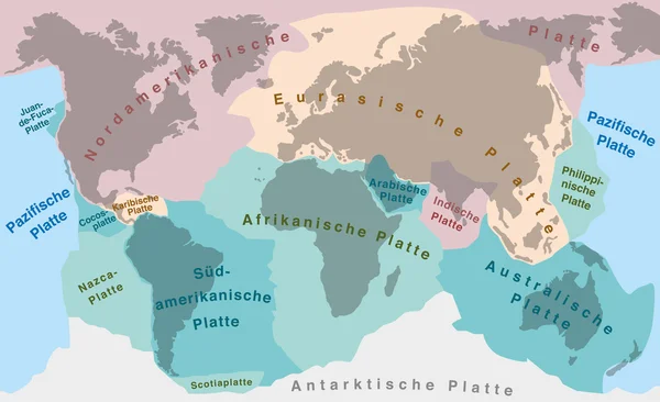
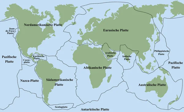
Tectonic plates of planet earth - map with names of major an minor plates. GERMAN LABELING!
Continental Drift Tectonic Plates German — Stock Vector
Plate tectonics- FRENCH TERMS! - planet earth with major an minor plates - vector illustration.
Plate Tectonics FRENCH TERMS — Stock Vector
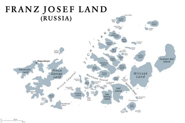
Franz Josef Land, gray political map. Russian archipelago in the Arctic Ocean, northernmost part of Arkhangelsk Oblast, largest island Prince George Land, and air base Nagurskoye. Illustration. Vector
Franz Josef Land Gray Political Map Russian Archipelago Arctic Ocean — Stock Vector
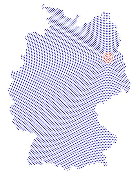
Germany map radial dot pattern. Blue dots going from the red dotted capital Berlin outwards and form the country silhouette with the island Ruegen. Illustration on white background.
Germany map radial dot pattern — Stock Vector
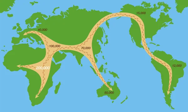
Global spread of humankind from africa 200000 years ago with their paths of expansion and time of settlement on the continents. Early human migration world map. Simplified chart.
Global Spread Humankind Africa 200000 Years Ago Paths Expansion Time — Stock Vector
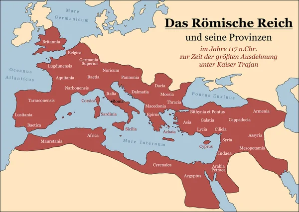
The Roman Empire at its greatest extent in 117 AD at the time of Trajan, plus principal provinces. German labeling! Vector illustration.
Roman Empire German — Stock Vector
Arctic Ocean sea routes, gray political map. Arctic shipping routes. Northwest Passage and Northern Sea Route. Maritime paths, used by vessels to navigate through the Arctic. Illustration. Vector.
Arctic Ocean Sea Routes Gray Political Map Arctic Shipping Routes — Stock Vector
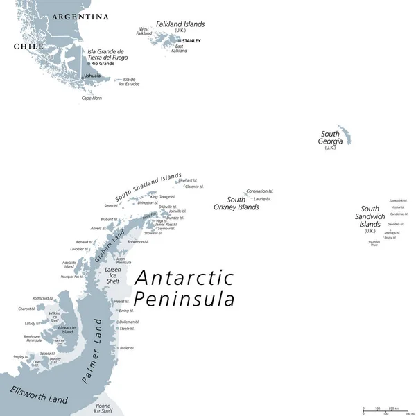
Antarctic Peninsula area, gray political map. From southern Patagonia and Falkland Islands, to South Georgia, and the South Sandwich Islands, and to South Orkney Islands, and Antarctic Peninsula.
Antarctic Peninsula Area Gray Political Map Southern Patagonia Falkland Islands — Stock Vector
Early human expansion from africa over the whole world, migration paths depicted with footprints, global expansion with moving direction and time of settlement on the continents. Vector chart.
Early Human Expansion Africa Whole World Migration Paths Depicted Footprints — Stock Vector
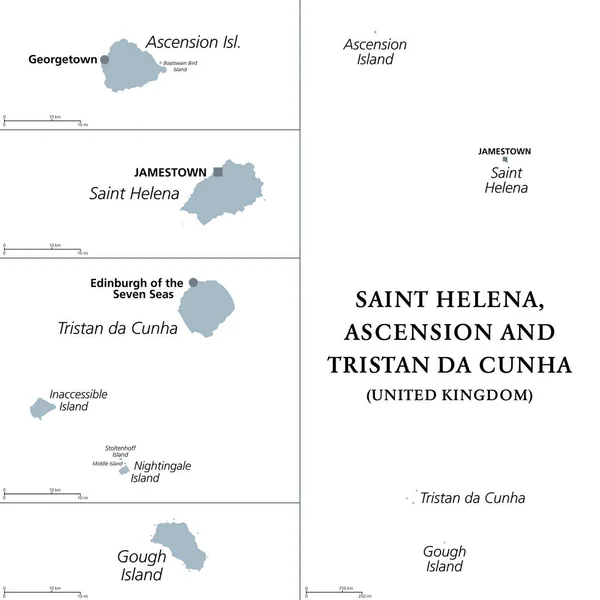
Saint Helena, Ascension and Tristan da Cunha, gray political map. British Overseas Territory in the South Atlantic, capital Jamestown. Saint Helena, Ascension, Tristan da Cunha archipelago, and Gough.
Saint Helena Ascension Tristan Cunha Gray Political Map British Overseas — Stock Vector
Plate tectonics- ITALIAN LABELING! - planet earth with major an minor plates - vector illustration.
Plate Tectonics ITALIAN LABELING — Stock Vector
Saint Helena, Ascension and Tristan da Cunha, political map. British Overseas Territory in the South Atlantic, with capital Jamestown. Saint Helena, Ascension, Tristan da Cunha archipelago, and Gough.
Saint Helena Ascension Tristan Cunha Political Map British Overseas Territory — Stock Vector
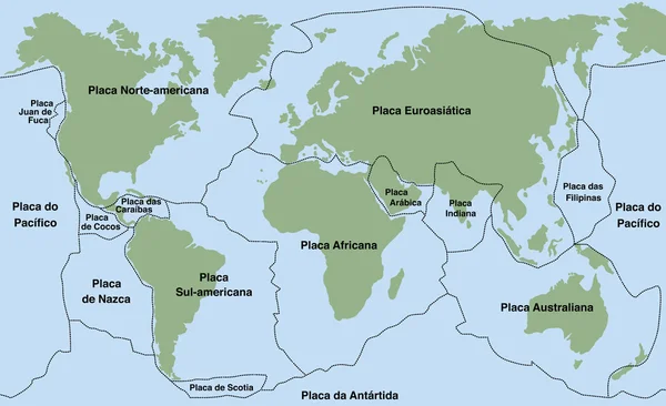
Plate tectonics- PORTUGUESE NAMES! - planet earth with major an minor plates - vector illustration.
Plate Tectonics PORTUGUESE NAMES — Stock Vector
Plate tectonics - planet earth with major an minor plates - GERMAN LABELING! Vector illustration.
Plate Tectonics German — Stock Vector
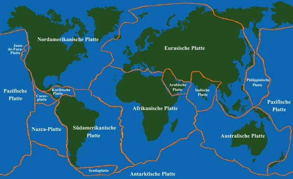
Plate tectonics - world map with fault lines of major an minor plates. GERMAN LABELING! Vector illustration.
Plate Tectonics Faultlines German — Stock Vector
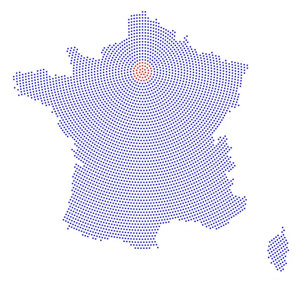
France map radial dot pattern. Blue dots going from the capital Paris outwards and form the hexagon silhouette of France with the island Corsica. Illustration on white background.
France map radial dot pattern — Stock Vector

Similar Stock Videos:
Spaceship flying around the world High definition animation colorful scenes
Spaceship flying around the world HD animation — Stock Video
Animation of globe spinning and data processing with networks of connections. global science, networks, technology and connections concept digitally generated video.
Animation Globe Spinning Data Processing Networks Connections Global Science Networks — Stock Video
Animation of globe and shapes on blue background. global environment, green energy and digital interface concept digitally generated video.
Animation Globe Shapes Blue Background Global Environment Green Energy Digital — Stock Video
Animation of a world map with Covid-19 infection rise on black background. Global public health coronavirus Covid 19 pandemic concept digital composite.
Animation World Map Covid Infection Rise Black Background Global Public — Stock Video
Animation of globe and shapes on blue background. global environment, green energy and digital interface concept digitally generated video.
Animation Globe Shapes Blue Background Global Environment Green Energy Digital — Stock Video
Info-Graphic for The Layers of the Earth
Info-Graphic for The Layers of the Earth — Stock Video
4k Global GPS data detect earth map military radar GPS navigation interface.
4k Global GPS data detect earth map military radar GPS navigation interface. — Stock Video
Animation of social media buttons over globe on blue background. global social media, connections and data processing concept digitally generated video.
Animation Social Media Buttons Globe Blue Background Global Social Media — Stock Video
The spread of the new coronavirus from China around the world. 4k video
The spread of the new coronavirus from China around the world. — Stock Video
Animation of national cancer day text and world map on purple background. national cancer day and celebration concept digitally generated video.
Animation National Cancer Day Text World Map Purple Background National — Stock Video
Animation of human faces flying and numbers increasing on white speech bubbles over world map on blue background. Global public health coronavirus Covid 19 pandemic concept digitally generated image.
Animation Human Faces Flying Numbers Increasing White Speech Bubbles World — Stock Video
Network of connections over spinning globe against statistical data processing. global networking and business technology concept
Network Connections Spinning Globe Statistical Data Processing Global Networking Business — Stock Video
4K Animation map on dark abstract background for futuristic technology concept
Animation Map Dark Abstract Background Futuristic Technology Concept — Stock Video
Cleaning worker with biosafety suit using sprayer and world planet ,4k video animated
Cleaning worker with biosafety suit using sprayer and world planet — Stock Video

Usage Information

You can use this royalty-free vector image "Winter Solstice" for personal and commercial purposes according to the Standard or Extended License. The Standard License covers most use cases, including advertising, UI designs, and product packaging, and allows up to 500,000 print copies. The Extended License permits all use cases under the Standard License with unlimited print rights and allows you to use the downloaded vector files for merchandise, product resale, or free distribution.

This stock vector image is scalable to any size. You can buy and download it in high resolution up to 9800x7030. Upload Date: Sep 11, 2013