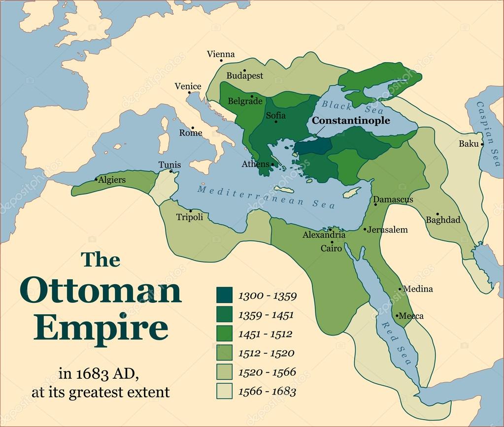
Ottoman Empire Acquisitions — Stock Vector

Ottoman Empire Acquisitions — Vector

The Ottoman Empire at its greatest extent in 1683. Vector illustration.

 — Vector by Furian

Same Series:

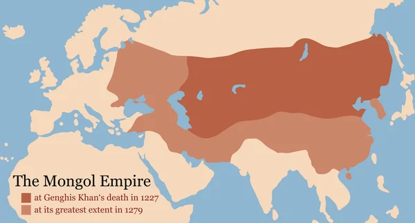
Mongol Empire map at Genghis Khan's death in 1227 and at its greatest extent in 1279. Vector illustration.
Mongol Empire Conquest Map — Stock Vector
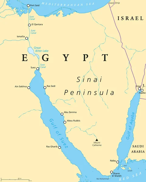
Egypt, Sinai Peninsula political map. Situated between Mediterranean Sea and Red Sea. Land bridge between Asia and Africa. Suez Canal, Gulf of Suez and Aqaba. Illustration. English labeling. Vector.
Egypt, Sinai Peninsula political map — Stock Vector
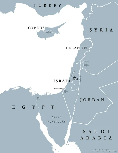
Eastern Mediterranean countries political map with national borders. Nations to the east of Mediterranean Sea, also called Levant. English labeling and scaling. Gray illustration on white background.
Eastern Mediterranean countries political map — Stock Vector
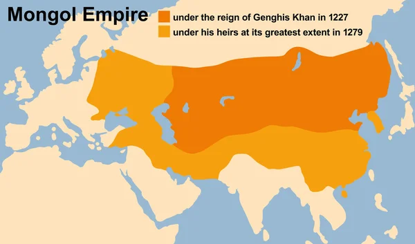
Genghis Khan's Mongol Empire in 1227 and at its greatest extent in 1279. Vector illustration.
Mongol Empire Genghis Khan — Stock Vector
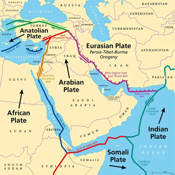
Arabian Plate, tectonic map. Minor tectonic plate, consisting mostly of the Arabian Peninsula. Together with the African and Indian plates it is moving northward, colliding with the Eurasian plate.
Arabian Plate Tectonic Map Minor Tectonic Plate Consisting Mostly Arabian — Stock Vector
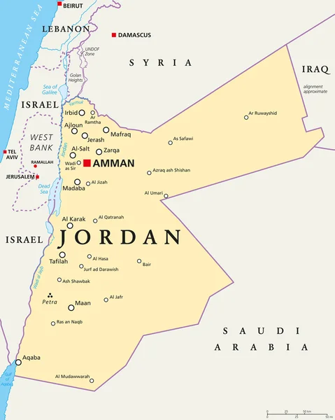
Jordan political map with capital Amman, national borders, important cities, rivers and lakes. English labeling and scaling. Illustration.
Jordan Political Map — Stock Vector
Lebanon political map with capital Beirut, national borders, important cities, rivers and lakes. English labeling and scaling. Illustration.
Lebanon Political Map — Stock Vector
Region of lands around the Mediterranean Sea. South Europe, North Africa and Near East with capitals, national borders, rivers and lakes. English labeling and scaling. Illustration.
Mediterranean Sea Region Political Map — Stock Vector
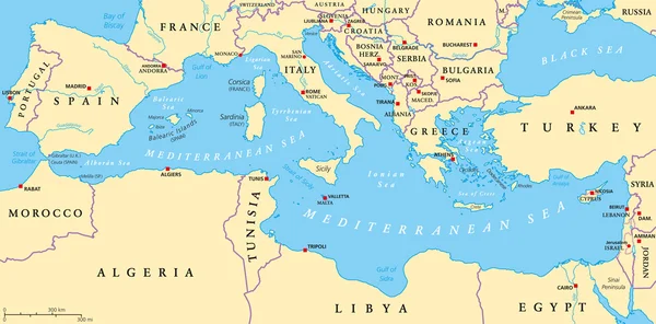
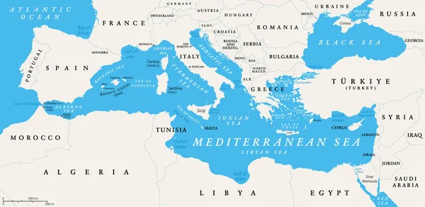
The Mediterranean Sea, political map with subdivisions, straits, islands and countries. Connected to the Atlantic Ocean, surrounded by the Mediterranean Basin, almost completely enclosed by land.
Mediterranean Sea Political Map Subdivisions Straits Islands Countries Connected Atlantic — Stock Vector
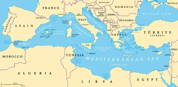
The Mediterranean Sea subdivisions, political map with straits, countries and the Black Sea. Connected to the Atlantic Ocean, surrounded by the Mediterranean Basin, almost completely enclosed by land.
Mediterranean Sea Subdivisions Political Map Straits Countries Black Sea Connected — Stock Vector
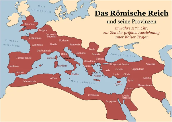
The Roman Empire at its greatest extent in 117 AD at the time of Trajan, plus principal provinces. German labeling! Vector illustration.
Roman Empire German — Stock Vector
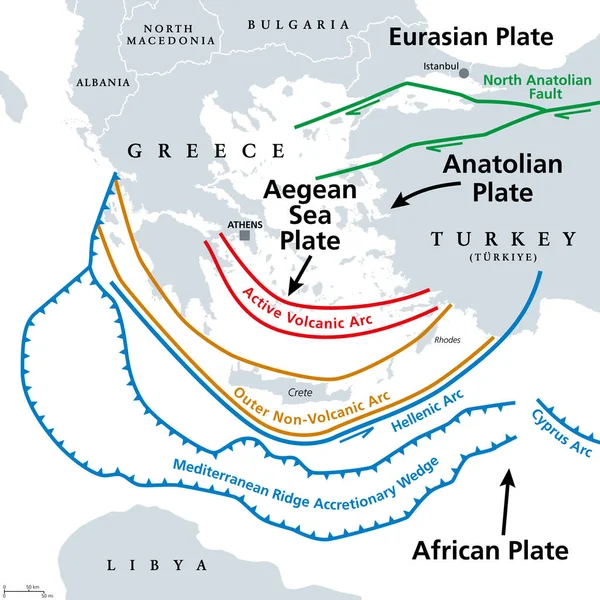
Aegean Sea Plate and Hellenic Arc, gray tectonic map. The Aegean or also Hellenic Plate, is a small tectonic plate, located in the eastern Mediterranean Sea, under southern Greece and western Turkey.
Aegean Sea Plate Hellenic Arc Gray Tectonic Map Aegean Also — Stock Vector
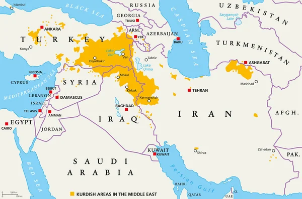
Kurdish areas in the Middle East, political map. Countries with their capitals, national borders and important cities. Kurdish areas in orange color. Illustration with English labeling. Vector.
Kurdish areas in the Middle East, political map — Stock Vector
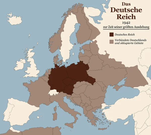
Third Reich at its greatest extent in 1942. Map of Nazi Germany in Europe in Second World War with todays state borders. GERMAN LABELING!
Third Reich Nazi Germany Greatest Extent German Text — Stock Vector
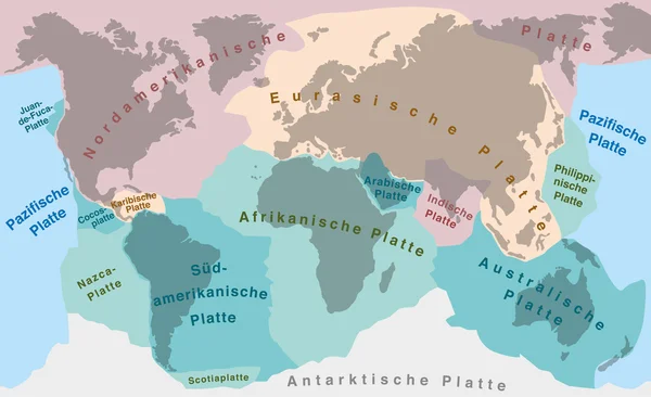
Tectonic plates of planet earth - map with names of major an minor plates. GERMAN LABELING!
Continental Drift Tectonic Plates German — Stock Vector
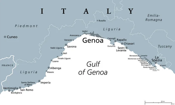
Liguria and the Italian Riviera, the Ligurian Riviera, gray political map. A region of north-western Italy, with capital Genoa. Coastal strip between Ventimiglia and La Spezia, on the Gulf of Genua.
Liguria Italian Riviera Ligurian Riviera Gray Political Map Region North — Stock Vector

Similar Stock Videos:
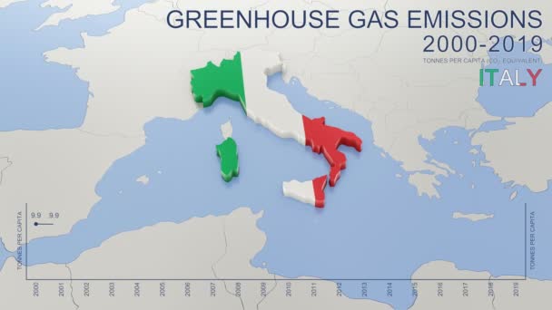
Greenhouse gas emissions in Italy from 2000 to 2019. Values in tonnes per capita (CO2 equivalent). Source data: Eurostat. 3D rendering loop able video with 4K resolution.
Greenhouse Gas Emissions Italy 2000 2019 Values Tonnes Capita Co2 — Stock Video
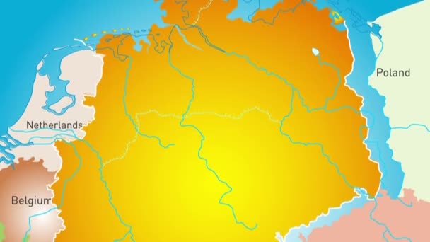
Animated detailed map of Germany country
Animated detailed map of Germany — Stock Video
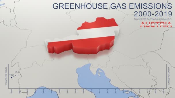
Greenhouse gas emissions in Austria from 2000 to 2019. Values in tonnes per capita (CO2 equivalent). Source data: Eurostat. 3D rendering loop able video with 4K resolution.
Greenhouse Gas Emissions Austria 2000 2019 Values Tonnes Capita Co2 — Stock Video
Uzbekistan map highlighted in Uzbekistan flag colors and pin of country capital Tashkent, map with neighboring Asian countries.
Uzbekistan Map Highlighted Uzbekistan Flag Colors Pin Country Capital Tashkent — Stock Video
India map highlighted in India flag colors and pin of country capital New Delhi, map with neighboring Asian countries.
India Map Highlighted India Flag Colors Pin Country Capital New — Stock Video
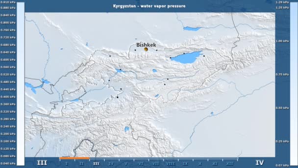
Water vapor pressure by month in the Kyrgyzstan area with animated legend - English labels: country and capital names, map description. Stereographic projection
Water Vapor Pressure Month Kyrgyzstan Area Animated Legend English Labels — Stock Video
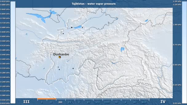
Water vapor pressure by month in the Tajikistan area with animated legend - English labels: country and capital names, map description. Stereographic projection
Water Vapor Pressure Month Tajikistan Area Animated Legend English Labels — Stock Video
Water vapor pressure by month in the Mongolia area with animated legend - English labels: country and capital names, map description. Stereographic projection
Water Vapor Pressure Month Mongolia Area Animated Legend English Labels — Stock Video
Water vapor pressure by month in the Moldova area with animated legend - English labels: country and capital names, map description. Stereographic projection
Water Vapor Pressure Month Moldova Area Animated Legend English Labels — Stock Video
Greenhouse gas emissions in Greece from 2000 to 2019. Values in tonnes per capita (CO2 equivalent). Source data: Eurostat. 3D rendering loop able video with 4K resolution.
Greenhouse Gas Emissions Greece 2000 2019 Values Tonnes Capita Co2 — Stock Video
Greenhouse gas emissions in France from 2000 to 2019. Values in tonnes per capita (CO2 equivalent). Source data: Eurostat. 3D rendering loop able video with 4K resolution.
Greenhouse Gas Emissions France 2000 2019 Values Tonnes Capita Co2 — Stock Video
The division of Europe and Asia on the map. the city Ekaterinburg divides Europe and Asia. Eurasia on the map Animation. Eurasia. Yekaterinburg animation HD
The division of Europe and Asia on the map. the city Ekaterinburg divides Europe and Asia. Eurasia on the map Animation. Eurasia. Yekaterinburg animation — Stock Video
Animation of the map of East Asia region
Animation of the map of East Asia — Stock Video
Soft colors of mountains and forests. Map of New York. Zoom from a world map to a map of New York. 4K FHD 60 fps animation.
Soft colors of mountains and forests. Map of New York. World map. Map of the USA. Zoom from a world map to a map of New York. Zoom from USA map to New York map. 4K FHD 60 fps animation. — Stock Video
Water vapor pressure by month in the Belgium area with animated legend - English labels: country and capital names, map description. Stereographic projection
Water Vapor Pressure Month Belgium Area Animated Legend English Labels — Stock Video
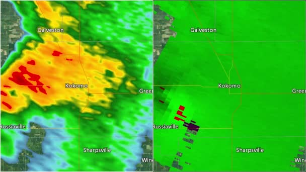
2016 Kokomo, IN tornado. Depicts radar imagery (reflectivity) on the left, and base velocity (wind speed and direction) on the right. Taken by National Weather Service NEXRAD radar.
2016 Kokomo, IN Tornado Doppler Radar Split-screen — Stock Video
Thank You Word Cloud in vector format.(multi language translation: Thank you)
Thank You Word Cloud Vector Format Multi Language Translation Thank — Stock Video
World map 3d cartography China
World Map Cartography China — Stock Video

Usage Information

You can use this royalty-free vector image "Ottoman Empire Acquisitions" for personal and commercial purposes according to the Standard or Extended License. The Standard License covers most use cases, including advertising, UI designs, and product packaging, and allows up to 500,000 print copies. The Extended License permits all use cases under the Standard License with unlimited print rights and allows you to use the downloaded vector files for merchandise, product resale, or free distribution.

This stock vector image is scalable to any size. You can buy and download it in high resolution up to 7082x6000. Upload Date: Dec 16, 2014