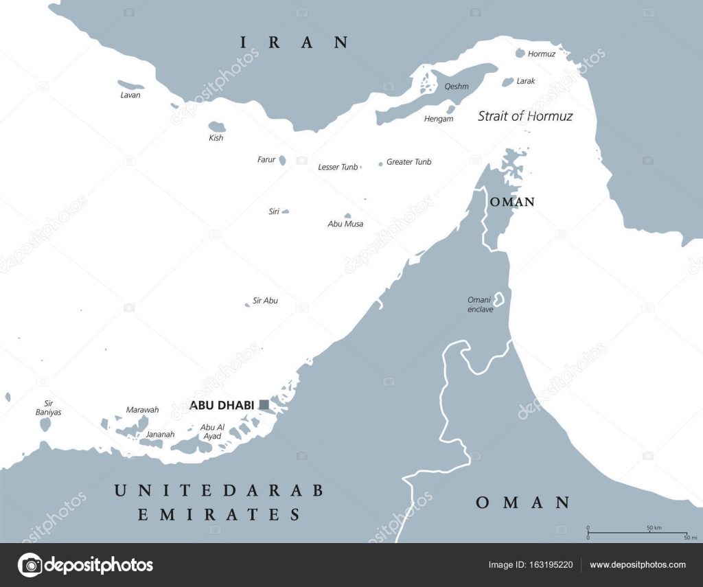
Strait of Hormuz region political map — Stock Vector

Strait of Hormuz region political map — Vector

Strait of Hormuz region political map. English labeling. Strait between the Persian Gulf and the Gulf of Oman. The only sea passage from the Persian Gulf to the open ocean. Gray illustration. Vector.

 — Vector by Furian

Same Series:

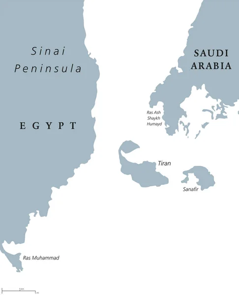
Straits of Tiran political map. Narrow sea passages between Sinai and Arabian peninsulas which seperate the Gulf of Aqaba from Red Sea. Gray illustration on white background. English labeling. Vector.
Straits of Tiran political map — Stock Vector
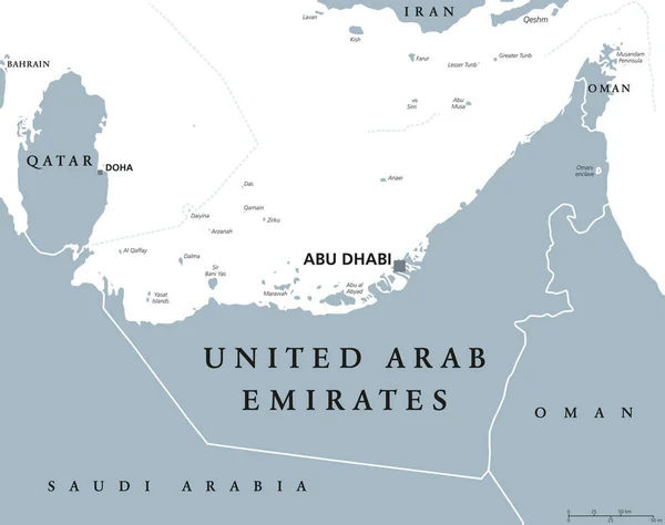
United Arab Emirates political map with capital Abu Dhabi. UAE, Emirates, a monarchy in Western Asia on northeastern coast of Arabian Peninsula. Gray illustration over white. English labeling. Vector.
United Arab Emirates political map — Stock Vector
Political map of Arabian Peninsula with capitals, national borders, rivers and lakes. Vector illustration with english labeling and scale.
Arabian Peninsula Political Map — Stock Vector
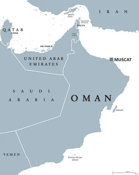
Oman political map with capital Muscat. Sultanate and Arab country in Western Asia and Middle East on the Arabian Peninsula. Gray illustration isolated on white background. English labeling. Vector.
Oman political map — Stock Vector
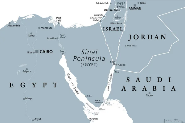
Sinai Peninsula, gray political map. Peninsula in Egypt, located between Mediterranean and Red Sea, a land bridge between the continents Asia and Africa. With parts of Israel, Jordan and Saudi Arabia.
Sinai Peninsula Gray Political Map Peninsula Egypt Located Mediterranean Red — Stock Vector
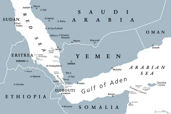
Gulf of Aden area, gray political map. Deepwater gulf between Yemen, Djibouti, the Guardafui Channel, Socotra and Somalia, connecting the Arabian Sea through the Bab-el-Mandeb strait with the Red Sea.
Gulf Aden Area Gray Political Map Deepwater Gulf Yemen Djibouti — Stock Vector
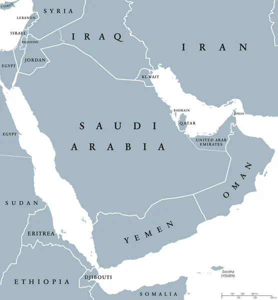
Arabian peninsula countries political map with national borders and single countries. Arabia is a peninsula of Western Asia, northeast of Africa. English labeling and scaling. Illustration over white.
Arabian peninsula countries political map — Stock Vector
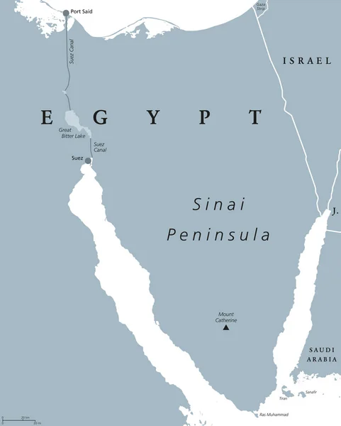
Sinai Peninsula political map. Land bridge in Egypt situated between Mediterranean Sea and Red Sea. With Suez Canal. Gray illustration isolated on white background. English labeling. Vector.
Sinai Peninsula, Egypt, political map — Stock Vector
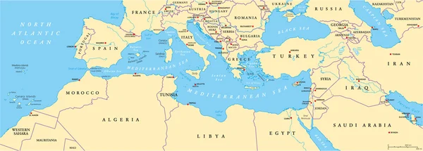
Mediterranean Basin Political Map. South Europe, North Africa and Near East with capitals, national borders, rivers and lakes. English labeling and scaling. Illustration.
Mediterranean Basin Political Map — Stock Vector
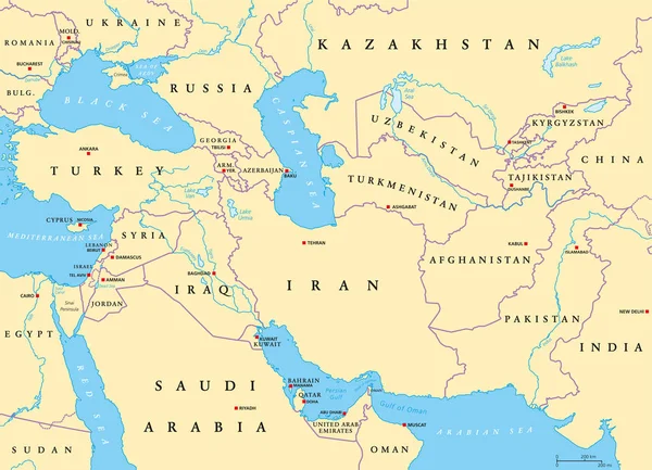
Southwest Asia, political map with capitals, borders, rivers and lakes. Also called Western, West or Southwestern Asia. Subregion, overlapping with Middle East. English labeling. Illustration. Vector.
Southwest Asia Political Map Capitals Borders Rivers Lakes Also Called — Stock Vector
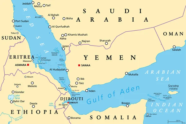
Gulf of Aden area, political map. Deepwater gulf between Yemen, Djibouti, the Guardafui Channel, Socotra and Somalia, connecting the Arabian Sea through the Bab-el-Mandeb strait with the Red Sea.
Gulf Aden Area Political Map Deepwater Gulf Yemen Djibouti Guardafui — Stock Vector
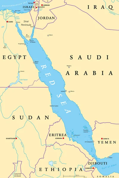
Red Sea region political map with capitals, borders, important cities, rivers and lakes. Erythraean Sea, seawater inlet of Indian Ocean between Africa and Asia. Illustration. English labeling. Vector.
Red Sea region political map — Stock Vector
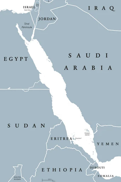
Red Sea political map. English labeling. Also called the Erythraean Sea. Seawater Inlet of the Indian Ocean between Horn of Africa and Arabian Peninsula. Gray illustration on white background. Vector.
Red Sea political map — Stock Vector
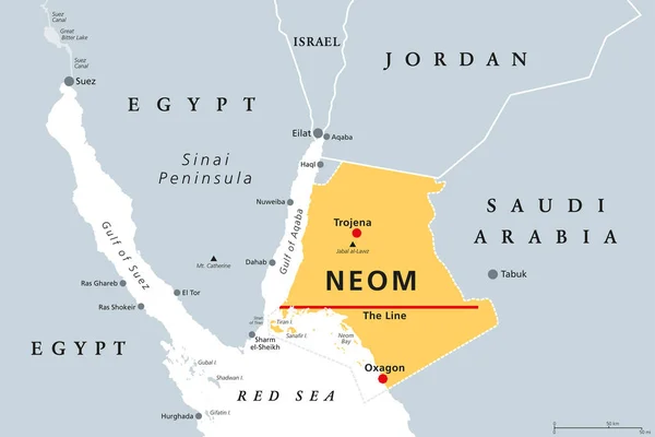
Neom, gray political map. Saudi megacity being built in the Tabuk Province of northwestern Saudi Arabia, North of the Red Sea and across Gulf of Aqaba. Planned as a smart city and tourist destination.
Neom Gray Political Map Saudi Megacity Being Built Tabuk Province — Stock Vector
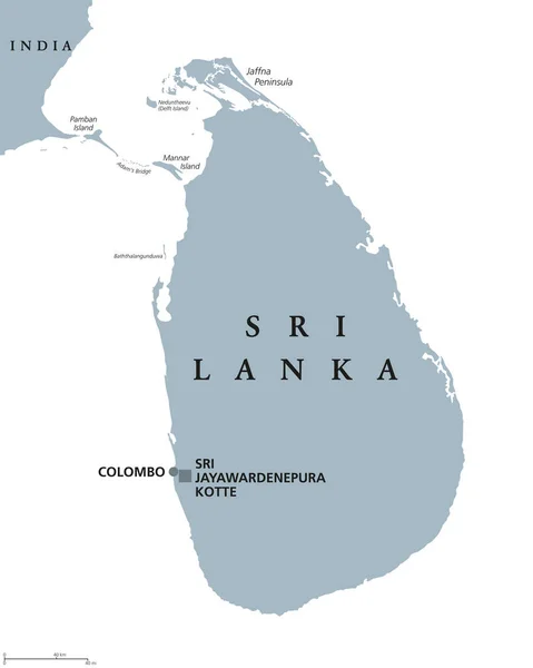
Sri Lanka political map with capitals Sri Jayawardenepura Kotte and Colombo. English labeling. Democratic Socialist Republic. Former Ceylon. Island country in South Asia. Gray illustration. Vector.
Sri Lanka political map — Stock Vector
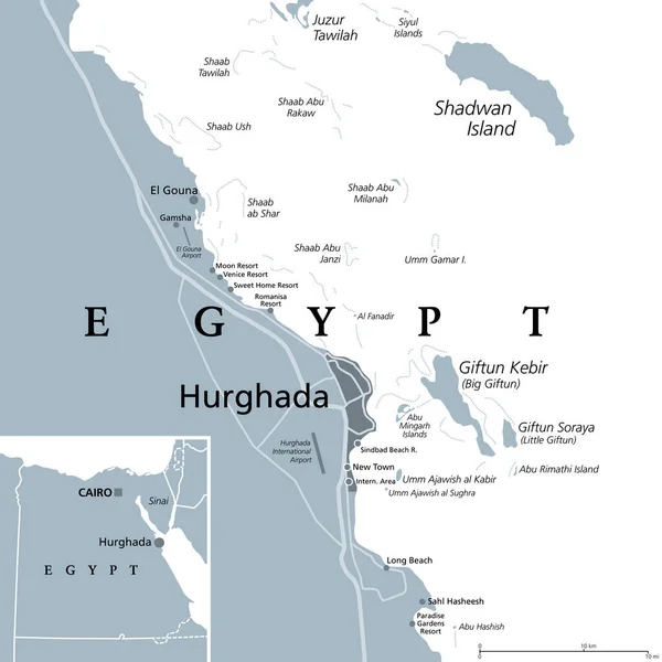
Hurghada and vicinity, Egypt, gray political map. City area in the Red Sea Governorate of Egypt, and one of the main tourist centres of the country, located on the Red Sea coast with numerous resorts.
Hurghada Vicinity Egypt Gray Political Map City Area Red Sea — Stock Vector

Similar Stock Videos:

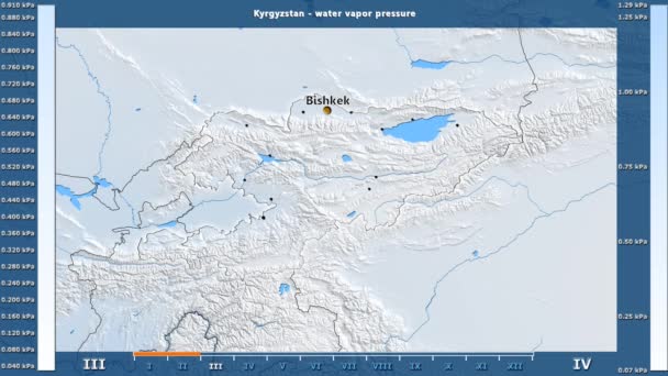
Water vapor pressure by month in the Kyrgyzstan area with animated legend - English labels: country and capital names, map description. Stereographic projection
Water Vapor Pressure Month Kyrgyzstan Area Animated Legend English Labels — Stock Video
India map highlighted in India flag colors and pin of country capital New Delhi, map with neighboring Asian countries.
India Map Highlighted India Flag Colors Pin Country Capital New — Stock Video
Uzbekistan map highlighted in Uzbekistan flag colors and pin of country capital Tashkent, map with neighboring Asian countries.
Uzbekistan Map Highlighted Uzbekistan Flag Colors Pin Country Capital Tashkent — Stock Video
Water vapor pressure by month in the Mongolia area with animated legend - English labels: country and capital names, map description. Stereographic projection
Water Vapor Pressure Month Mongolia Area Animated Legend English Labels — Stock Video
Water vapor pressure by month in the Tajikistan area with animated legend - English labels: country and capital names, map description. Stereographic projection
Water Vapor Pressure Month Tajikistan Area Animated Legend English Labels — Stock Video
Water vapor pressure by month in the Moldova area with animated legend - English labels: country and capital names, map description. Stereographic projection
Water Vapor Pressure Month Moldova Area Animated Legend English Labels — Stock Video
Greenhouse gas emissions in Italy from 2000 to 2019. Values in tonnes per capita (CO2 equivalent). Source data: Eurostat. 3D rendering loop able video with 4K resolution.
Greenhouse Gas Emissions Italy 2000 2019 Values Tonnes Capita Co2 — Stock Video
Greenhouse gas emissions in Austria from 2000 to 2019. Values in tonnes per capita (CO2 equivalent). Source data: Eurostat. 3D rendering loop able video with 4K resolution.
Greenhouse Gas Emissions Austria 2000 2019 Values Tonnes Capita Co2 — Stock Video
Animated detailed map of Germany country
Animated detailed map of Germany — Stock Video
Water vapor pressure by month in the Belgium area with animated legend - English labels: country and capital names, map description. Stereographic projection
Water Vapor Pressure Month Belgium Area Animated Legend English Labels — Stock Video
James Cook. great geographical discoveries. trip around the world
The great world tour - James Cook. — Stock Video
Solar radiation by month in the Panama area with animated legend - raw color shader. Stereographic projection
Solar Radiation Month Panama Area Animated Legend Raw Color Shader — Stock Video
Neuquen blinking red highlighted in map of Argentina
Neuquen Blinking Red Highlighted Map Argentina — Stock Video
Sibiu, county of Romania, with its capital, localized, outlined and zoomed with informative overlays on a solid patterned map in the Stereographic projection
Sibiu location. Romania. Solid patterned map — Stock Video
Solar radiation by month in the Dominican Republic area with animated legend - raw color shader. Stereographic projection
Solar Radiation Month Dominican Republic Area Animated Legend Raw Color — Stock Video
Water vapor pressure by month in the Ireland area with animated legend - raw color shader. Stereographic projection
Water Vapor Pressure Month Ireland Area Animated Legend Raw Color — Stock Video
North Macedonia map highlighted in Macedonia flag colors and pin of country capital Skopje, map with neighboring European countries.
North Macedonia Map Highlighted Macedonia Flag Colors Pin Country Capital — Stock Video
Brexit - simple animated map showing the United Kingdom changing its status after leaving the European Union - 2016's referendum - blue flat design
Brexit - simple animated map showing the United Kingdom changing its status after leaving the European Union - 2016's referendum - blue flat design — Stock Video

Usage Information

You can use this royalty-free vector image "Strait of Hormuz region political map" for personal and commercial purposes according to the Standard or Extended License. The Standard License covers most use cases, including advertising, UI designs, and product packaging, and allows up to 500,000 print copies. The Extended License permits all use cases under the Standard License with unlimited print rights and allows you to use the downloaded vector files for merchandise, product resale, or free distribution.

This stock vector image is scalable to any size. You can buy and download it in high resolution up to 9033x6978. Upload Date: Aug 12, 2017