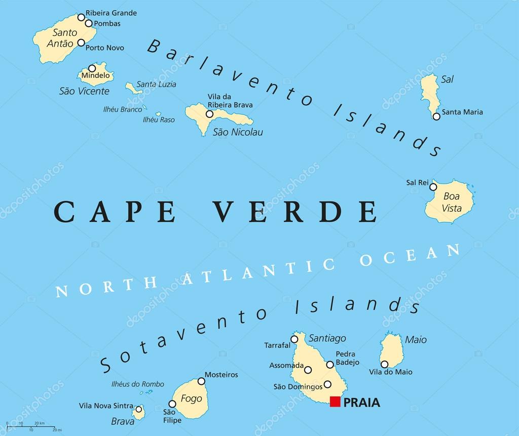
Cape Verde Political Map — Stock Vector

Cape Verde Political Map — Vector

Cape Verde Political Map with capital Praia and important cities. English labeling and scaling. Illustration.

 — Vector by Furian

Same Series:

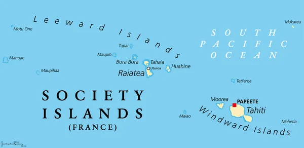
Society Islands, political map. Group of volcanic islands, in French Polynesia, an overseas collectivity of France, in the South Pacific Ocean. Archipelago, divided into Leeward and Windward Islands.
Society Islands Political Map Group Volcanic Islands French Polynesia Overseas — Stock Vector
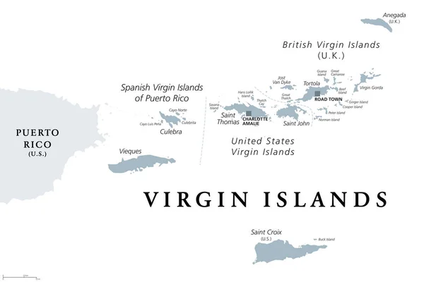
British, Spanish and United States Virgin Islands, gray political map. Archipelago in the Caribbean Sea. British overseas territory and unincorporated territories of the USA. Illustration. Vector.
British Spanish United States Virgin Islands Gray Political Map Archipelago — Stock Vector
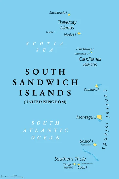
South Sandwich Islands, political map. Part of the British Overseas Territory of South Georgia and the South Sandwich Islands. Group of islands in the South Atlantic Ocean and Scotia Sea. Vector.
South Sandwich Islands Political Map Part British Overseas Territory South — Stock Vector
Grenada political map with capital St. Georges. Island Country and part of the Windward Islands and Lesser Antilles in the Caribbean Sea. English labeling and scaling. Illustration.
Grenada Political Map — Stock Vector
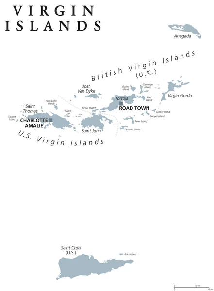
Virgin Islands political map. Island group between Caribbean Sea and Atlantic Ocean. Part of Lesser Antilles and Leeward Islands. Gray illustration on white background. English labeling. Vector.
Virgin Islands political map — Stock Vector
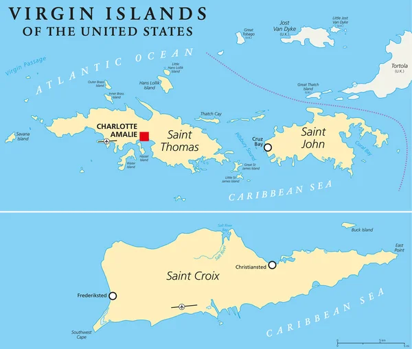
United States Virgin Islands Political Map. A group of islands in the Caribbean that are an insular area of the United States. English labeling and scaling. Illustration.
United States Virgin Islands Political Map — Stock Vector
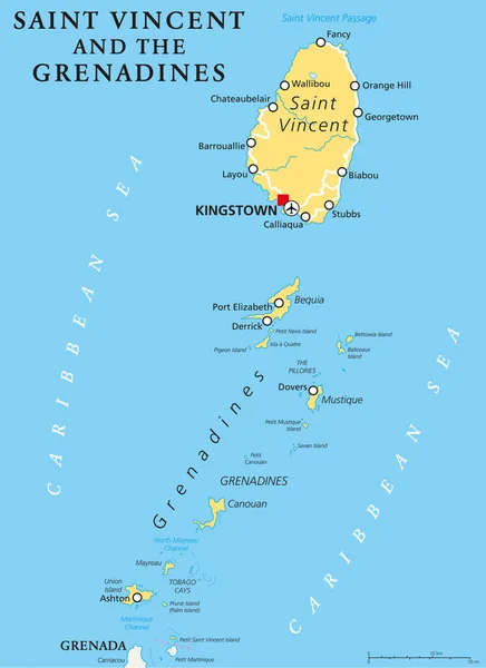
Saint Vincent and the Grenadines political map with capital Kingstown. Island country in the Lesser Antilles Island arc. English labeling and scaling. Illustration.
Saint Vincent and the Grenadines Political Map — Stock Vector
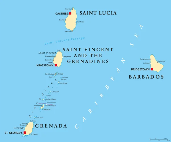
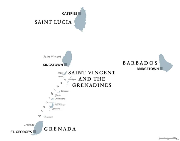
Barbados, Grenada, Saint Lucia, Saint Vincent and the Grenadines political map. Island countries in the Caribbean, part of Lesser Antilles and Windward Islands. Illustration. English labeling. Vector.
Barbados, Grenada, Saint Lucia and Saint Vincent political map — Stock Vector
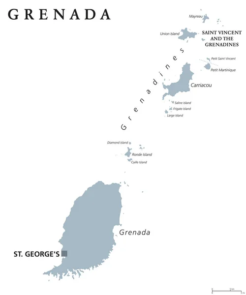
Grenada political map with capital St George's. Caribbean islands country and part of the Lesser Antilles and Windward Islands. Gray illustration isolated on white background. English labeling. Vector
Grenada political map — Stock Vector
Barbados, Grenada, Saint Lucia, Saint Vincent and the Grenadines political map. Caribbean islands, part of Lesser Antilles and Windward Islands. Gray illustration over white. English labeling. Vector.
Barbados, Grenada, Saint Lucia, Saint Vincent political map — Stock Vector
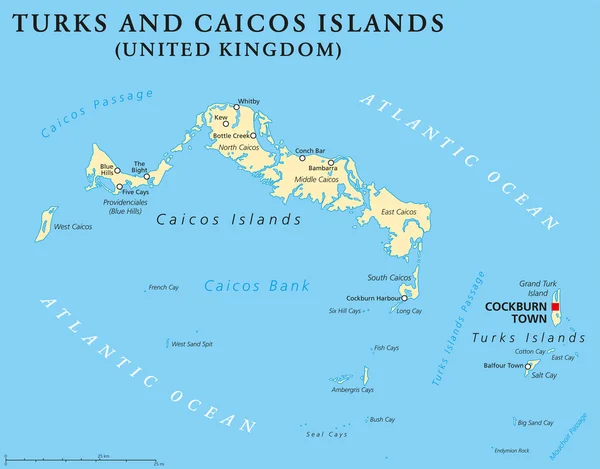
Turks and Caicos Islands political map with capital Cockburn Town. British Overseas Territory with two groups of tropical islands in the Lucayan Archipelago. English labeling and scaling.
Turks and Caicos Islands Political Map — Stock Vector
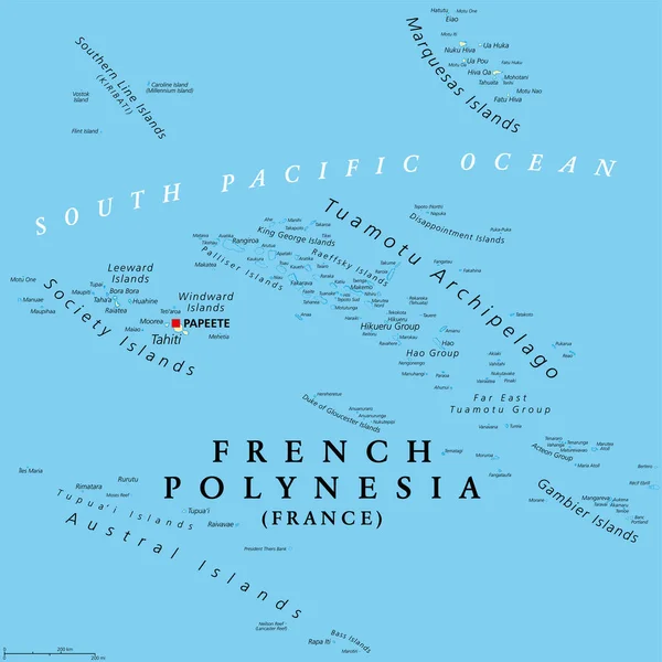
French Polynesia, political map. Overseas collectivity of France, and its sole overseas country, in the South Pacific Ocean, with 121 islands and atolls, and capital Papeete, on the island of Tahiti.
French Polynesia Political Map Overseas Collectivity France Its Sole Overseas — Stock Vector
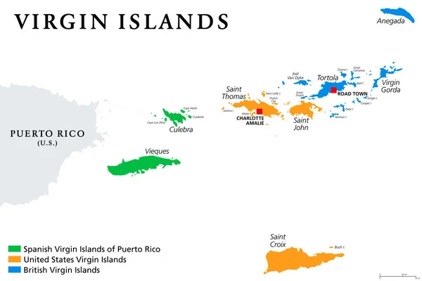
Virgin Islands map with political jurisdictions. British, Spanish and U.S. Virgin Islands in the Caribbean. British overseas territory and unincorporated territories of the USA. Illustration. Vector.
Virgin Islands Map Political Jurisdictions British Spanish Virgin Islands Caribbean — Stock Vector
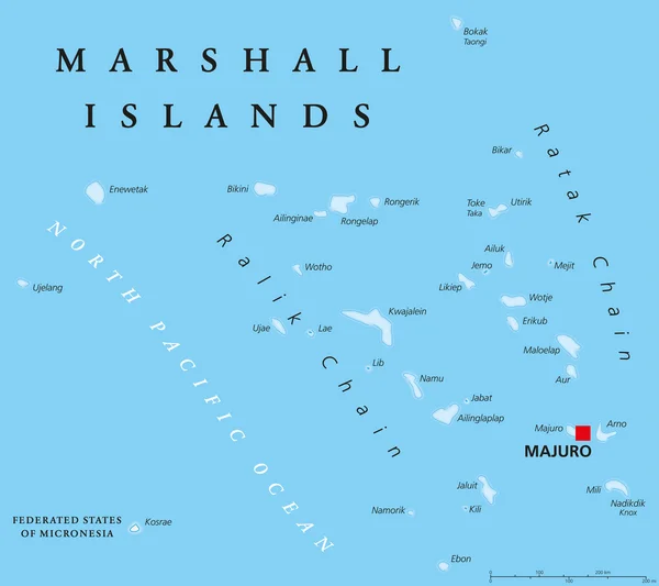
Marshall Islands political map with capital Majuro. Republic and island country near the equator in the Pacific Ocean in Micronesia. English labeling. Illustration.
Marshall Islands Political Map — Stock Vector
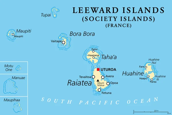
Leeward Islands, political map. Western part of the Society Islands in French Polynesia, an overseas collectivity of France in the South Pacific. Uturoa, on the largest island Raiatea, is the capital.
Leeward Islands Political Map Western Part Society Islands French Polynesia — Stock Vector
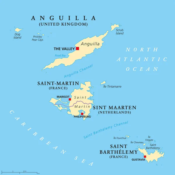
Anguilla, Saint-Martin, Sint Maarten and Saint Barthelemy political map. Islands in the Caribbean, part of Leeward Islands and Lesser Antilles. English labeling. Illustration. Vector.
Anguilla, Saint-Martin, Sint Maarten and Saint Barthelemy map — Stock Vector

Similar Stock Videos:
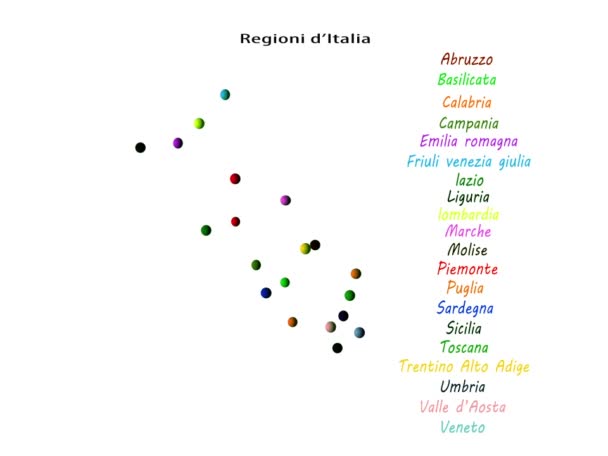
Map of Italy regions
Regioni d'italia — Stock Video
End Racism word cloud on a white background.
End Racism Word Cloud White Background — Stock Video
Japanese. Cursor Slides Over and Clicks Save Document. Mouse Pointer on Device Computer Monitor Screen Clicking Saving File Processor For Company Business Assignment or School Education Project.
Japanese Cursor Slides Clicks Document Mouse Pointer Device Computer Monitor — Stock Video
Japanese. Cursor Slides Over and Clicks Open Existing Document. Mouse Pointer on Device Computer Monitor Screen Clicking Retrieve File Processor For Company Business Assignment or School Education Project.
Japanese Cursor Slides Clicks Open Existing Document Mouse Pointer Device — Stock Video
Japanese. Cursor Slides Over and Clicks Save As Title Document. Mouse Pointer on Device Computer Monitor Screen Clicking Saving Name File Processor For Company Business Assignment or School Education Project.
Japanese Cursor Slides Clicks Title Document Mouse Pointer Device Computer — Stock Video
Japanese. Cursor Slides Over and Clicks Print Spreadsheet. Mouse Pointer on Device Computer Monitor Screen Clicking Printing Worksheet File For Company Business Assignment or School Education Project.
Japanese Cursor Slides Clicks Print Spreadsheet Mouse Pointer Device Computer — Stock Video
End Racism animated word cloud on a white background.
End Racism Animated Word Cloud White Background — Stock Video
Japanese. Cursor Slides Over and Clicks Save As Title Spreadsheet. Mouse Pointer on Device Computer Monitor Screen Clicking Saving Name File Worksheet For Company Business Assignment or School Education Project.
Japanese Cursor Slides Clicks Title Spreadsheet Mouse Pointer Device Computer — Stock Video
Ketogenic animated word cloud on a white background.
Ketogenic Animated Word Cloud White Background — Stock Video
Psychotherapy animated word cloud on a white background.
Psychotherapy Animated Word Cloud White Background — Stock Video
Healing Beliefs Brain animated word cloud on a white background.
Healing Beliefs Brain Animated Word Cloud White Background — Stock Video
Affirmations word cloud on a white background.
Affirmations Word Cloud White Background — Stock Video
Inflammation word cloud on a white background.
Inflammation Word Cloud White Background — Stock Video
Mobile Device Word Cloud Animation SET. White, black, gray background. 4k resolution
Mobile Device Word Cloud Animation SET. White, black, gray  background. — Stock Video
Product Trade animated word cloud on a white background.
Product Trade Animated Word Cloud White Background — Stock Video
Blended Family animated word cloud on a white background.
Blended Family Animated Word Cloud White Background — Stock Video
Affirmations animated word cloud on a white background.
Affirmations Animated Word Cloud White Background — Stock Video
Halloween text background animation motion graphics
Halloween Text Background Animation Motion Graphics — Stock Video

Usage Information

You can use this royalty-free vector image "Cape Verde Political Map" for personal and commercial purposes according to the Standard or Extended License. The Standard License covers most use cases, including advertising, UI designs, and product packaging, and allows up to 500,000 print copies. The Extended License permits all use cases under the Standard License with unlimited print rights and allows you to use the downloaded vector files for merchandise, product resale, or free distribution.

This stock vector image is scalable to any size. You can buy and download it in high resolution up to 7135x6000. Upload Date: Nov 23, 2014