Toadstool Trail Leads Area Hoodoos Balanced Rock Formations Created Centuries — Stock Photo, Image

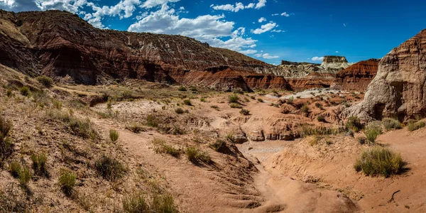
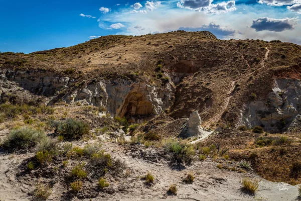
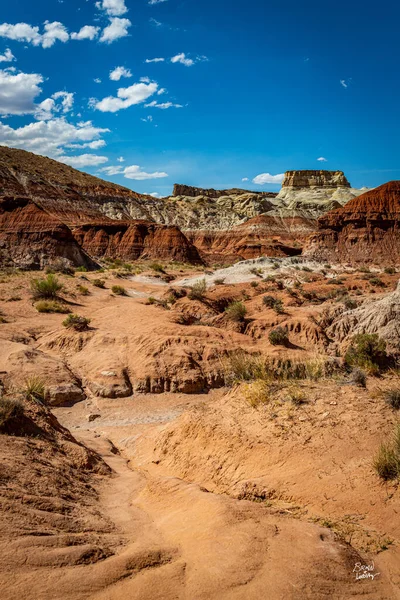
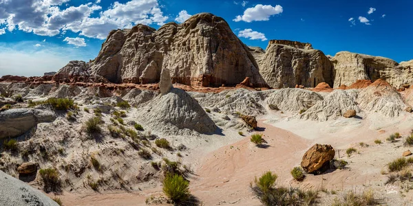
The Toadstool Trail leads to an area of hoodoos and balanced rock formations created by centuries of erosion and is part of the Grand Staircase-Escalante National Monument in Kane County, Utah. — Photo

The Toadstool Trail leads to an area of hoodoos and balanced rock formations created by centuries of erosion and is part of the Grand Staircase-Escalante National Monument in Kane County, Utah.

 — Photo by adifferentbrian

Same Series:

The Toadstool Trail leads to an area of hoodoos and balanced rock formations created by centuries of erosion and is part of the Grand Staircase-Escalante National Monument in Kane County, Utah.
Toadstool Trail Leads Area Hoodoos Balanced Rock Formations Created Centuries — Stock Photo, Image
The Toadstool Trail leads to an area of hoodoos and balanced rock formations created by centuries of erosion and is part of the Grand Staircase-Escalante National Monument in Kane County, Utah.
Toadstool Trail Leads Area Hoodoos Balanced Rock Formations Created Centuries — Stock Photo, Image
The Toadstool Trail leads to an area of hoodoos and balanced rock formations created by centuries of erosion and is part of the Grand Staircase-Escalante National Monument in Kane County, Utah.
Toadstool Trail Leads Area Hoodoos Balanced Rock Formations Created Centuries — Stock Photo, Image
The Toadstool Trail leads to an area of hoodoos and balanced rock formations created by centuries of erosion and is part of the Grand Staircase-Escalante National Monument in Kane County, Utah.
Toadstool Trail Leads Area Hoodoos Balanced Rock Formations Created Centuries — Stock Photo, Image
Canyons and eroded sandstone and limestone formations dominate the landscape at Capitol Reef National Park in Utah.
Canyons Eroded Sandstone Limestone Formations Dominate Landscape Capitol Reef National — Stock Photo, Image
The Toadstool Trail leads to an area of hoodoos and balanced rock formations created by centuries of erosion and is part of the Grand Staircase-Escalante National Monument in Kane County, Utah.
Toadstool Trail Leads Area Hoodoos Balanced Rock Formations Created Centuries — Stock Photo, Image
The Toadstool Trail leads to an area of hoodoos and balanced rock formations created by centuries of erosion and is part of the Grand Staircase-Escalante National Monument in Kane County, Utah.
Toadstool Trail Leads Area Hoodoos Balanced Rock Formations Created Centuries — Stock Photo, Image
Hoodoo and eroded cliff formations at Bryce Canyon National Park in Utah.
Hoodoo Eroded Cliff Formations Bryce Canyon National Park Utah — Stock Photo, Image
The Toadstool Trail leads to an area of hoodoos and balanced rock formations created by centuries of erosion and is part of the Grand Staircase-Escalante National Monument in Kane County, Utah.
Toadstool Trail Leads Area Hoodoos Balanced Rock Formations Created Centuries — Stock Photo, Image
The Toadstool Trail leads to an area of hoodoos and balanced rock formations created by centuries of erosion and is part of the Grand Staircase-Escalante National Monument in Kane County, Utah.
Toadstool Trail Leads Area Hoodoos Balanced Rock Formations Created Centuries — Stock Photo, Image
The Toadstool Trail leads to an area of hoodoos and balanced rock formations created by centuries of erosion and is part of the Grand Staircase-Escalante National Monument in Kane County, Utah.
Toadstool Trail Leads Area Hoodoos Balanced Rock Formations Created Centuries — Stock Photo, Image
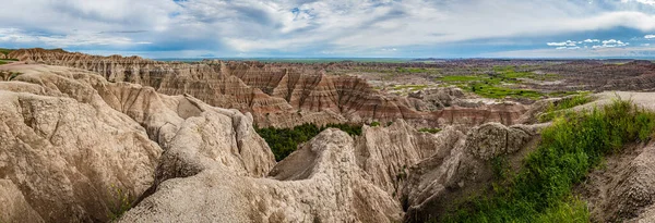
Badlands National Park is located in southwestern South Dakota, featuring nearly 400 square miles of sharply eroded buttes and pinnacles, and the largest undisturbed mixed grass prairie in the United States.
Badlands National Park Located Southwestern South Dakota Featuring Nearly 400 — Stock Photo, Image

Usage Information

You can use this royalty-free photo "The Toadstool Trail leads to an area of hoodoos and balanced rock formations created by centuries of erosion and is part of the Grand Staircase-Escalante National Monument in Kane County, Utah." for personal and commercial purposes according to the Standard or Extended License. The Standard License covers most use cases, including advertising, UI designs, and product packaging, and allows up to 500,000 print copies. The Extended License permits all use cases under the Standard License with unlimited print rights and allows you to use the downloaded stock images for merchandise, product resale, or free distribution.

You can buy this stock photo and download it in high resolution up to 11578x5789. Upload Date: Oct 1, 2020