Kyrgyzstan Political Map — Stock Vector

Kyrgyzstan Political Map — Vector

Kyrgyzstan political map with capital Bishkek, national borders, important cities, rivers and lakes. Kyrgyz Republic, formerly known as Kirghizia. Landlocked country in Central Asia. English labeling.

 — Vector by Furian

Same Series:

Turkmenistan political map with capital Ashgabat. Formerly known as Turkmenia, a country in Central Asia on the Caspian Sea. Gray illustration on white background with English labeling. Vector.
Turkmenistan political map — Stock Vector
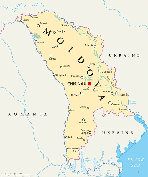
Moldova political map with capital Chisinau, national borders, important cities, rivers and lakes. English labeling and scaling. Illustration.
Moldova Political Map — Stock Vector
Caspian Sea region political map with borders and countries. Body of water, basin, and largest lake on earth between Europe and Asia. Gray illustration. Vector.
Caspian Sea region political map — Stock Vector
Tajikistan political map with capital Dushanbe and borders. Republic and landlocked country in Central Asia. Gray illustration. English labeling. Vector.
Tajikistan political map — Stock Vector
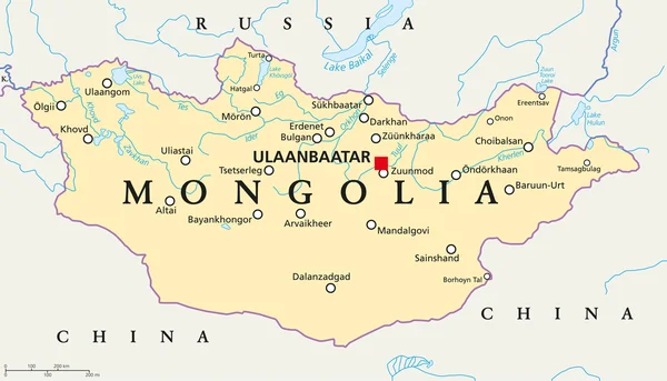
Mongolia political map with capital Ulaanbaatar, national borders, important cities, rivers and lakes. Landlocked sovereign state in East Asia, bordered to China and Russia. English labeling.
Mongolia Political Map — Stock Vector
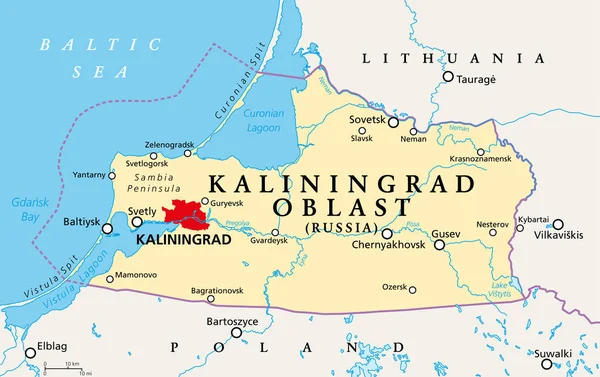
Kaliningrad Oblast, political map. Kaliningrad Region, federal subject and semi-enclave of Russia, located on the coast of the Baltic Sea, with administrative centre Kaliningrad. Illustration. Vector.
Kaliningrad Oblast Political Map Kaliningrad Region Federal Subject Semi Enclave — Stock Vector
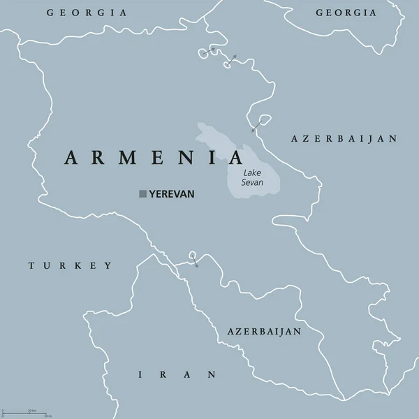
Armenia political map with capital Yerevan. Republic and sovereign state and in South Caucasus and Middle East region. Gray illustration isolated on white background. English labeling. Vector.
Armenia political map — Stock Vector
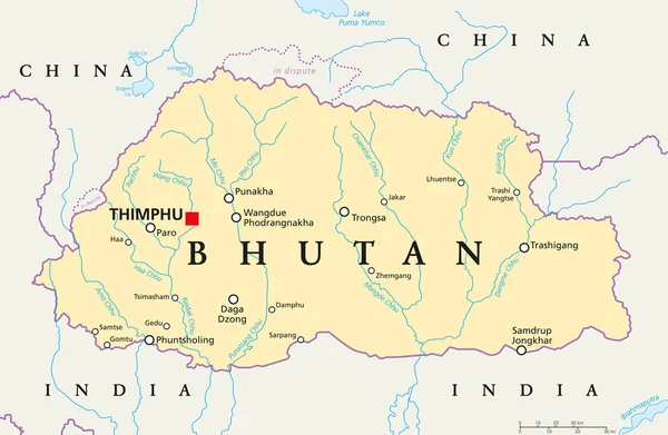
Bhutan political map with capital Thimphu, national borders, important cities, rivers and lakes. Landlocked kingdom in South Asia, Eastern Himalaya. English labeling. Illustration.
Bhutan Political Map — Stock Vector
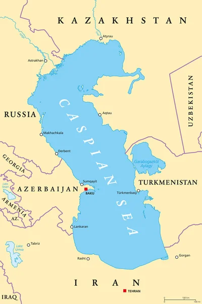
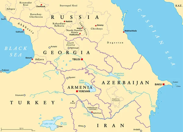
Caspian Sea region political map with most important cities, borders, rivers and lakes. Body of water, basin, and largest lake on earth between Europe and Asia. Illustration. English labeling. Vector.
Caspian Sea region political map — Stock Vector
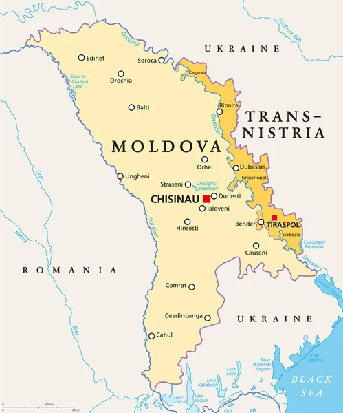
Moldova and Transnistria, political map. Republic of Moldova, with capital Chisinau, and the Pridnestrovian Moldavian Republic, PMR, a disputed and unrecognized breakaway state, with capital Tiraspol.
Moldova Transnistria Political Map Republic Moldova Capital Chisinau Pridnestrovian Moldavian — Stock Vector
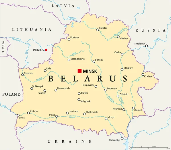
Belarus Political Map with capital Minsk, national borders, important cities, rivers and lakes. English labeling and scaling. Illustration.
Belarus Political Map — Stock Vector
The Caucasus, or Caucasia, political map. A region between the Black Sea and the Caspian Sea, mainly occupied by Armenia, Azerbaijan, Georgia, and parts of Southern Russia, with disputed areas. Vector
Caucasus Caucasia Political Map Region Black Sea Caspian Sea Mainly — Stock Vector
Political map of Bulgaria with the capital Sofia, national borders, most important cities, rivers and lakes. Vector illustration with english labeling and scale.
Bulgaria Political Map — Stock Vector
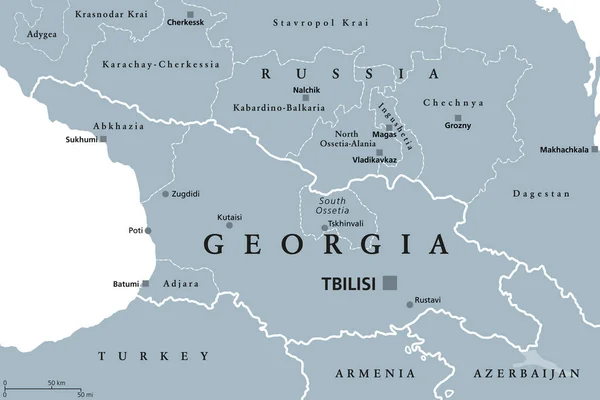
Georgia, gray political map, with capital Tbilisi, and international borders. Republic and transcontinental country in Eurasia, located south of North Caucasus Federal District of Russia. Illustration
Georgia Gray Political Map Capital Tbilisi International Borders Republic Transcontinental — Stock Vector
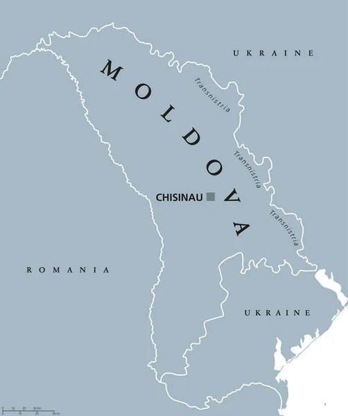
Moldova political map with capital Chisinau, Transnistria, national borders and neighbors. Also Moldavia, landlocked republic and country in Eastern Europe. Gray illustration. English labeling. Vector
Moldova political map — Stock Vector
Moldova and Transnistria, gray political map. Republic of Moldova, with capital Chisinau, and Pridnestrovian Moldavian Republic, PMR, a disputed and unrecognized breakaway state with capital Tiraspol.
Moldova Transnistria Gray Political Map Republic Moldova Capital Chisinau Pridnestrovian — Stock Vector

Similar Stock Videos:
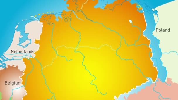
Animated detailed map of Germany country
Animated detailed map of Germany — Stock Video
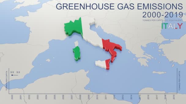
Greenhouse gas emissions in Italy from 2000 to 2019. Values in tonnes per capita (CO2 equivalent). Source data: Eurostat. 3D rendering loop able video with 4K resolution.
Greenhouse Gas Emissions Italy 2000 2019 Values Tonnes Capita Co2 — Stock Video
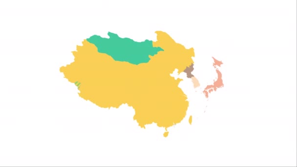
Animation of the map of East Asia region
Animation of the map of East Asia — Stock Video
Brazil on a political map of the world. Video defocuses showing and hiding the map.
Brazil Political Map World Video Defocuses Showing Hiding Map — Stock Video
World map 3d cartography China
World Map Cartography China — Stock Video
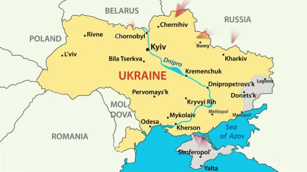
War in Ukraine. Russia attacked Ukraine February 24, 2022. Animated map of Russia invasion of Ukraine, the movement of troops. Ukrainians are fighting for their freedom and democracy
War in Ukraine — Stock Video
War in Ukraine. Russia attacked Ukraine February 24, 2022. Animated map of Russia invasion of Ukraine, the movement of troops. Ukrainians are fighting for their freedom and democracy
War in Ukraine — Stock Video
Sudan on a political map of the world. Video defocuses showing and hiding the map.
Sudan Political Map World Video Defocuses Showing Hiding Map — Stock Video
Blue and dark blue. Map of New York. Zoom from a world map to a map of New York. 4K FHD 60 fps animation.
Blue and dark blue. Map of New York. World map. Map of the USA. Zoom from a world map to a map of New York. Zoom from USA map to New York map. 4K FHD 60 fps animation. — Stock Video
3D animation simulating the Ebola Virus Spreading to Europe from the African outbreak countries
Ebola Virus Spreading to Europe — Stock Video
Animation of the map of South America continent
Animation of the map of South america — Stock Video
South Sudan on a political map of the world. Video defocuses showing and hiding the map.
South Sudan Political Map World Video Defocuses Showing Hiding Map — Stock Video
Animation of the map of the USA
Animation of the map of the United States of America — Stock Video
Guatemala, Honduras, and Nicaragua on a political map of the world. Video defocuses showing and hiding the map.
Guatemala Honduras Nicaragua Political Map World Video Defocuses Showing Hiding — Stock Video
Soft colors of mountains and forests. Map of New York. Zoom from a world map to a map of New York. 4K FHD 60 fps animation.
Soft colors of mountains and forests. Map of New York. World map. Map of the USA. Zoom from a world map to a map of New York. Zoom from USA map to New York map. 4K FHD 60 fps animation. — Stock Video
Alaska on a political map of the world. Video defocuses showing and hiding the map.
Alaska Political Map World Video Defocuses Showing Hiding Map — Stock Video
The division of Europe and Asia on the map. the city Ekaterinburg divides Europe and Asia. Eurasia on the map Animation. Eurasia. Yekaterinburg animation HD
The division of Europe and Asia on the map. the city Ekaterinburg divides Europe and Asia. Eurasia on the map Animation. Eurasia. Yekaterinburg animation — Stock Video
Close-up view map of Ukraine.
Close View Map Ukraine — Stock Video

Usage Information

You can use this royalty-free vector image "Kyrgyzstan Political Map" for personal and commercial purposes according to the Standard or Extended License. The Standard License covers most use cases, including advertising, UI designs, and product packaging, and allows up to 500,000 print copies. The Extended License permits all use cases under the Standard License with unlimited print rights and allows you to use the downloaded vector files for merchandise, product resale, or free distribution.

This stock vector image is scalable to any size. You can buy and download it in high resolution up to 9000x5390. Upload Date: Jul 14, 2016