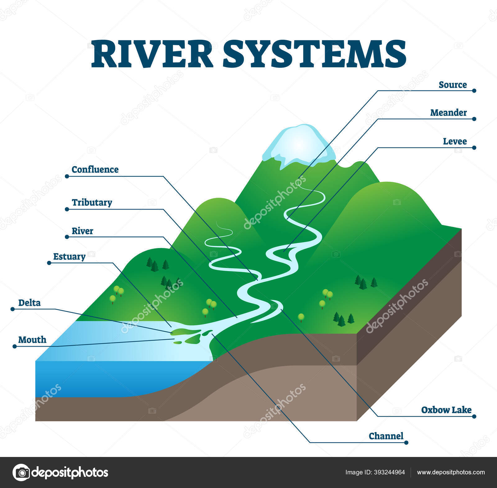
River systems and drainage basin educational structure vector illustration — Stock Vector

River systems and drainage basin educational structure vector illustration — Vector

River systems and drainage basin educational structure vector illustration. Geological description with water flow from source to sea. Labeled scheme with levee, confluence, tributary, delta and oxbow

 — Vector by VectorMine

Same Series:

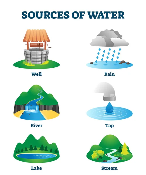
Sources of clean and fresh drinking water as natural resource vector illustration. Ecological H2O supply from well, rain, river, tap, lake or stream. Labeled educational liquid environment collection
Sources of clean drinking water as natural eco resource vector illustration — Stock Vector
Water cycle graphic scheme, vector isometric illustration with water bodies and geological relief.
Water cycle graphic scheme, vector isometric illustration. — Stock Vector
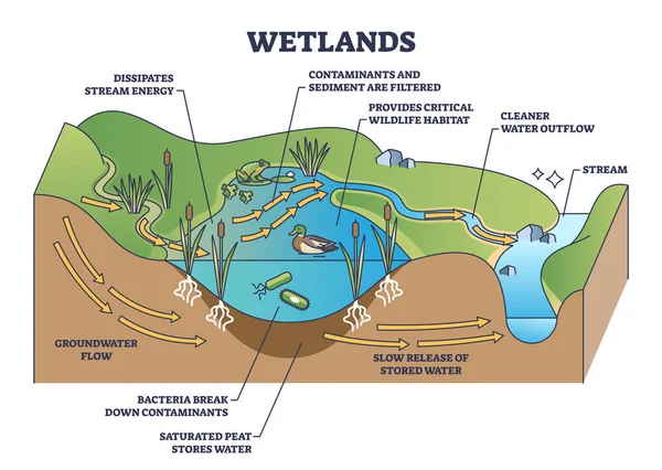
Wetlands environment description as wet soil with water outline diagram. Labeled educational biological scheme with flora or fauna for animal habitats vector illustration. Ecosystem creation principle
Wetlands Environment Description Wet Soil Water Outline Diagram Labeled Educational — Stock Vector
Earths water vector illustration. Labeled global liquids ecosystem scheme. Environmental fresh ocean, river, sea and groundwater summed together. Calculation with supply diagram for climate water life
Earths water vector illustration. Labeled global liquids ecosystem scheme. — Stock Vector
Limnology study as inland water and aquatic nature research outline concept. Lake, river, reservoir and wetlands scientific investigation to inspect geological characteristics vector illustration.
Limnology Study Inland Water Aquatic Nature Research Outline Concept Lake — Stock Vector
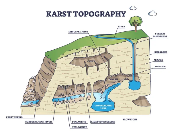
Karst topography as geological underground cave formation explanation outline diagram. Labeled educational detailed ground structure with limestone cavern, stalactite or stalagmite vector illustration
Karst topography and geological underground cave formation outline diagram — Stock Vector
Water Cycle vector illustration diagram. Evaporation to condensation, transportation, precipitation, infiltration and percolation. Ecosystem scheme with ocean, clouds, rain, snow, lakes and rivers.
Water Cycle vector illustration diagram. Geo science ecosystem scheme. — Stock Vector
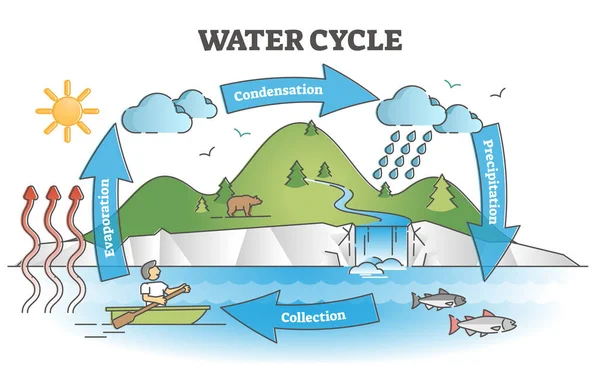
Water cycle diagram with simple rain circulation explanation outline concept. Educational biology climate scheme with precipitation, evaporation, condensation and collection phases vector illustration
Water cycle diagram with simple rain circulation explanation outline concept — Stock Vector
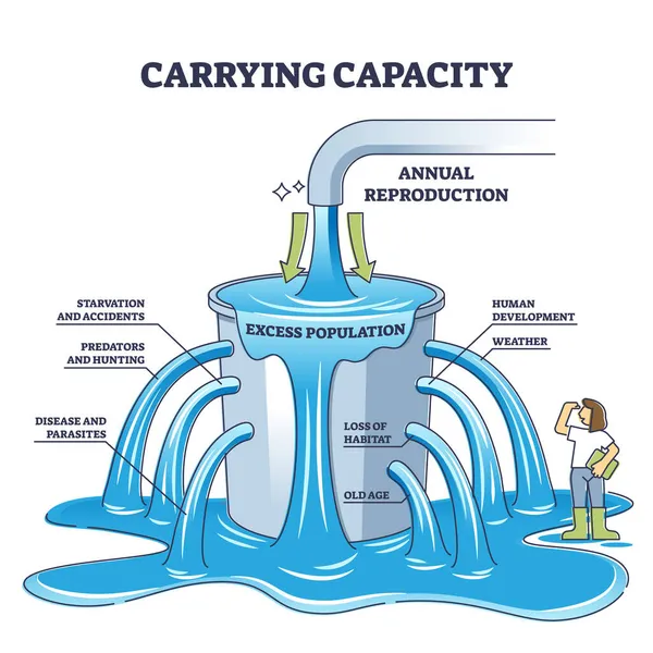
Carrying capacity as maximum population size for population outline diagram. Labeled educational explanation for sustainable balance between nature and society annual reproduction vector illustration.
Carrying capacity as maximum population size for population outline diagram — Stock Vector
Cryosphere elements educational scheme with ice and water outline diagram. Snow cap, glacier, permafrost and iceberg location description as geological pole and antarctica parts vector illustration.
Cryosphere elements educational scheme with ice and water outline diagram — Stock Vector
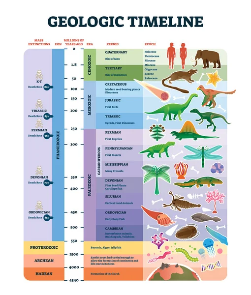
Geologic timeline scale vector illustration. Labeled earth history scheme with epoch, era, period, EON and mass extinctions diagram. Educational inforgraphic with examples, explanation and description
Geologic timeline scale vector illustration. Labeled earth history scheme. — Stock Vector
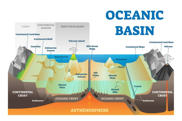
Ocean basin structure vector illustration. Labeled geography educational underwater level scheme with coast, continental margin and crust. Geological explanation with deep atlantic or pacific elements
Ocean basin structure vector illustration. Labeled underwater level scheme. — Stock Vector
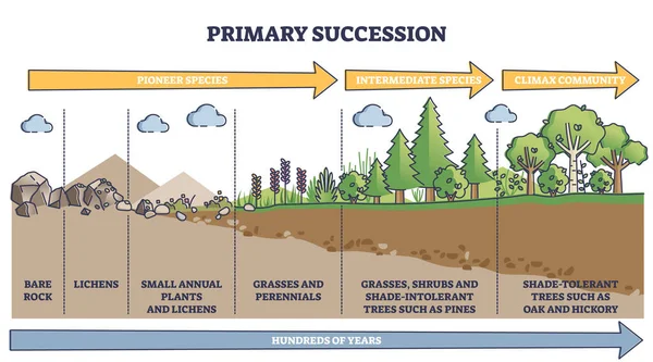
Primary succession and ecological growth process stages outline diagram. Labeled educational species progress explanation with time axis for organic matter long term formation vector illustration.
Primary succession and ecological growth process stages outline diagram — Stock Vector
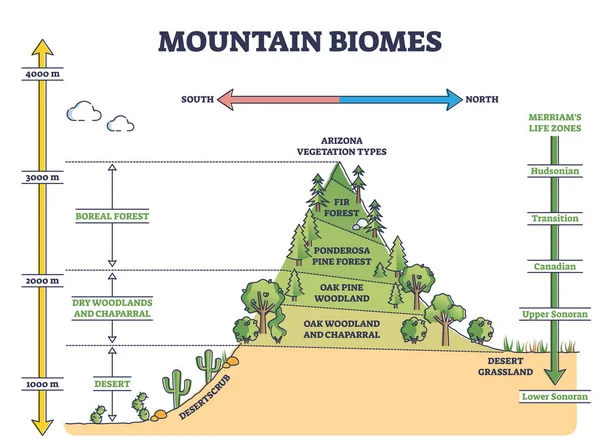
Mountain biomes with altitude and merriams life zones axis outline diagram. Educational climate and flora ecosystem description with labeled educational arizona vegetation types vector illustration.
Mountain biomes with altitude and merriams life zones axis outline diagram — Stock Vector
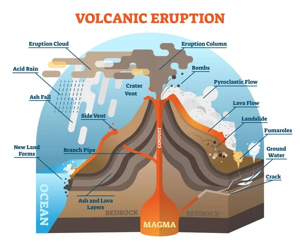
Volcanic eruption vector illustration scheme with isometric terrain diagram.
Volcanic eruption vector illustration scheme. — Stock Vector
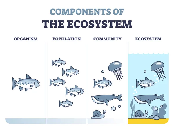
Components of environmental ecosystem with organism, population or community outline diagram. Educational labeled biology classification levels as living organisms division system vector illustration.
Components of ecosystem as organism, population and community outline diagram — Stock Vector

Similar Stock Videos:

Usage Information

You can use this royalty-free vector image "River systems and drainage basin educational structure vector illustration" for personal and commercial purposes according to the Standard or Extended License. The Standard License covers most use cases, including advertising, UI designs, and product packaging, and allows up to 500,000 print copies. The Extended License permits all use cases under the Standard License with unlimited print rights and allows you to use the downloaded vector files for merchandise, product resale, or free distribution.

This stock vector image is scalable to any size. You can buy and download it in high resolution up to 4200x3864. Upload Date: Jul 19, 2020