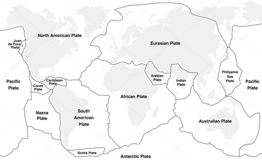
Tectonic Plates Names — Stock Vector

Tectonic Plates Names — Vector

Tectonic plates with names - world map with fault lines of major an minor plates.

 — Vector by Furian

Same Series:

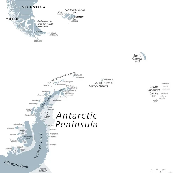
Antarctic Peninsula area, gray political map. From southern Patagonia and Falkland Islands, to South Georgia, and the South Sandwich Islands, and to South Orkney Islands, and Antarctic Peninsula.
Antarctic Peninsula Area Gray Political Map Southern Patagonia Falkland Islands — Stock Vector
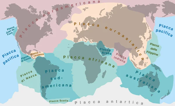
Tectonic Plates - ITALIAN LABELING! - world map with major an minor plates - vector illustration.
Tectonic Plates ITALIAN LABELING — Stock Vector
Drake Passage, political map. Mar de Hoces, Hoces Sea, body of water between Cape Horn and Antarctica Peninsula. Connect South Atlantic Ocean with South Pacific Ocean, extends into Southern Ocean.
Drake Passage Political Map Mar Hoces Hoces Sea Body Water — Stock Vector
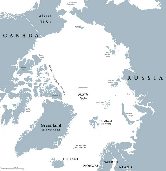
Arctic region political map. Polar region around the North Pole at the northernmost part of Earth. The Arctic Ocean without ice. Gray illustration with English labeling on white background. Vector.
Arctic region political map — Stock Vector
Antarctica political map. The Antarctic polar region around the Earth South Pole with islands and ice shelves. Gray illustration with English labeling on white background. Vector.
Antarctic region political map — Stock Vector
Worlds largest deserts like Sahara, Gobi, Kalahari, Arabian, Patagonian and Great Basin Desert. Global map with yellow desert climate. Vector illustration.
Worlds Largest Deserts Sahara Gobi Kalahari Arabian Patagonian Great Basin — Stock Vector
Lesser Antilles political map. Caribbees with Haiti, Dominican Republic and Puerto Rico in the Caribbean Sea. Gray illustration with English labeling on white background. Vector.
Lesser Antilles political map — Stock Vector
Global spread of humankind from africa 200000 years ago with their paths of expansion and time of settlement on the continents. Early human migration world map. Simplified chart.
Global Spread Humankind Africa 200000 Years Ago Paths Expansion Time — Stock Vector
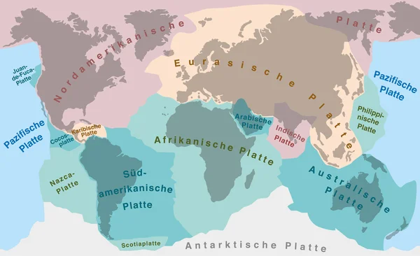
Tectonic plates of planet earth - map with names of major an minor plates. GERMAN LABELING!
Continental Drift Tectonic Plates German — Stock Vector
Tectonic Plates - SPANISH TEXT! - world map with major an minor plates - vector illustration.
Tectonic Plates SPANISH TEXT — Stock Vector
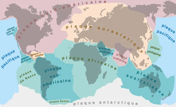
Tectonic Plates - FRENCH TERMS! - world map with major an minor plates - vector illustration.
Tectonic Plates FRENCH TERMS — Stock Vector
Vasco da Gama, Portuguese explorer, his first voyage from Lisbon around Africa to India, discovery of the sea route through the Atlantic and Indian Ocean. Vector map illustration.
Vasco Gama Portuguese Explorer His First Voyage Lisbon Africa India — Stock Vector
Human migration paths from africa 200000 years ago, with moving direction and time of settlement on the continents. Global spread of humankind chart. Vector illustration.
Human Migration Paths Africa 200000 Years Ago Moving Direction Time — Stock Vector
Antarctic Region Political Map with south pole, ice shelfs and islands. English labeling and scaling. Illustration.
Antarctic Region Political Map — Stock Vector
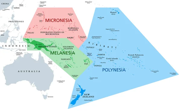
Melanesia, Micronesia and Polynesia, political map. Colored geographic regions of Oceania, southeast of the Asia-Pacific region. English labeling. Illustration on white background. Vector.
Melanesia Micronesia Polynesia Political Map Colored Geographic Regions Oceania Southeast — Stock Vector
Indian Ocean political map with countries and borders. English labeling. Bounded by Asia, Africa, Australia and Antarctica. Named after the country India. Gray illustration on white background. Vector
Indian Ocean political map — Stock Vector

Similar Stock Videos:
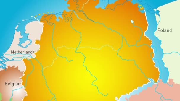
Animated detailed map of Germany country
Animated detailed map of Germany — Stock Video
Uzbekistan map highlighted in Uzbekistan flag colors and pin of country capital Tashkent, map with neighboring Asian countries.
Uzbekistan Map Highlighted Uzbekistan Flag Colors Pin Country Capital Tashkent — Stock Video
India map highlighted in India flag colors and pin of country capital New Delhi, map with neighboring Asian countries.
India Map Highlighted India Flag Colors Pin Country Capital New — Stock Video
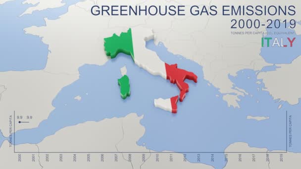
Greenhouse gas emissions in Italy from 2000 to 2019. Values in tonnes per capita (CO2 equivalent). Source data: Eurostat. 3D rendering loop able video with 4K resolution.
Greenhouse Gas Emissions Italy 2000 2019 Values Tonnes Capita Co2 — Stock Video
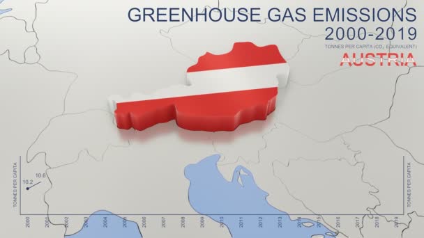
Greenhouse gas emissions in Austria from 2000 to 2019. Values in tonnes per capita (CO2 equivalent). Source data: Eurostat. 3D rendering loop able video with 4K resolution.
Greenhouse Gas Emissions Austria 2000 2019 Values Tonnes Capita Co2 — Stock Video
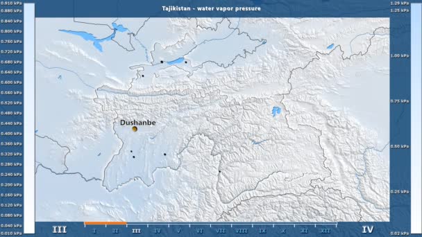
Water vapor pressure by month in the Tajikistan area with animated legend - English labels: country and capital names, map description. Stereographic projection
Water Vapor Pressure Month Tajikistan Area Animated Legend English Labels — Stock Video
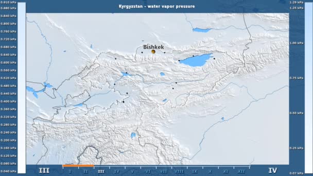
Water vapor pressure by month in the Kyrgyzstan area with animated legend - English labels: country and capital names, map description. Stereographic projection
Water Vapor Pressure Month Kyrgyzstan Area Animated Legend English Labels — Stock Video
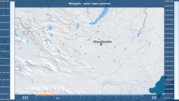
Water vapor pressure by month in the Mongolia area with animated legend - English labels: country and capital names, map description. Stereographic projection
Water Vapor Pressure Month Mongolia Area Animated Legend English Labels — Stock Video
James Cook. great geographical discoveries. trip around the world
The great world tour - James Cook. — Stock Video
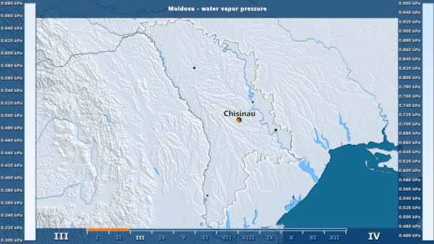
Water vapor pressure by month in the Moldova area with animated legend - English labels: country and capital names, map description. Stereographic projection
Water Vapor Pressure Month Moldova Area Animated Legend English Labels — Stock Video
Water vapor pressure by month in the Belgium area with animated legend - English labels: country and capital names, map description. Stereographic projection
Water Vapor Pressure Month Belgium Area Animated Legend English Labels — Stock Video
North Macedonia map highlighted in Macedonia flag colors and pin of country capital Skopje, map with neighboring European countries.
North Macedonia Map Highlighted Macedonia Flag Colors Pin Country Capital — Stock Video
Burundi map highlighted in Burundi flag colors and pin of country capital Gitega, map with neighboring African countries.
Burundi Map Highlighted Burundi Flag Colors Pin Country Capital Gitega — Stock Video
Luxembourg map highlighted in Luxembourg flag colors and pin of country capital Baku, map with neighboring European countries.
Luxembourg Map Highlighted Luxembourg Flag Colors Pin Country Capital Baku — Stock Video
Slovenia map highlighted in Slovenia flag colors and pin of country capital Ljubljana, map with neighboring European countries.
Slovenia Map Highlighted Slovenia Flag Colors Pin Country Capital Ljubljana — Stock Video
Kenya map highlighted in Kenya flag colors and pin of country capital Nairobi, map with neighboring African countries.
Kenya Map Highlighted Kenya Flag Colors Pin Country Capital Nairobi — Stock Video
Moldova map highlighted in Moldova flag colors and pin of country capital Chisinau, map with neighboring European countries.
Moldova Map Highlighted Moldova Flag Colors Pin Country Capital Chisinau — Stock Video
Lithuania map highlighted in Lithuania flag colors and pin of country capital Vilnius, map with neighboring European countries.
Lithuania Map Highlighted Lithuania Flag Colors Pin Country Capital Vilnius — Stock Video

Usage Information

You can use this royalty-free vector image "Tectonic Plates Names" for personal and commercial purposes according to the Standard or Extended License. The Standard License covers most use cases, including advertising, UI designs, and product packaging, and allows up to 500,000 print copies. The Extended License permits all use cases under the Standard License with unlimited print rights and allows you to use the downloaded vector files for merchandise, product resale, or free distribution.

This stock vector image is scalable to any size. You can buy and download it in high resolution up to 9000x5495. Upload Date: Oct 29, 2016